Blog

Galesville, Maryland

I finally made it to my last planned stop at Galesville, Maryland to visit an old college buddy Warren and his wife Jill. We have been friends since the 60’s, having shared many wild and wonderful adventures that somehow didn’t result in either of us dying or being seriously injured. Several of our adventures, such as a gold prospecting adventure to Kodiak Island Alaska had the potential for disaster, but we managed to side-step the ever present dangers. We don’t get together very often, but when we do there are plenty of topics to reminisce.

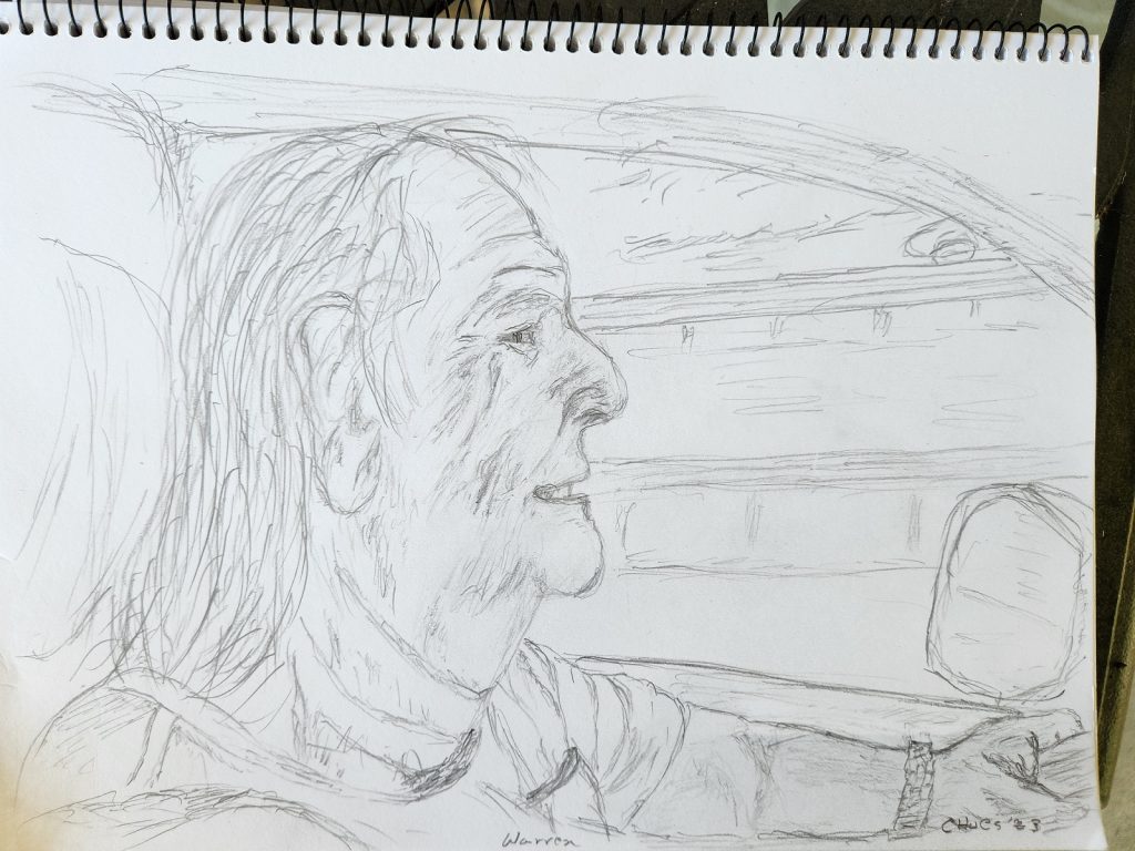
It turned out that I ran out of time by the time I got to their house, so I decided to sell my car, ship my gear home, and fly back to Sacramento. I had already planned on trading my car in on a new one as soon as I got back, so it made sense to just sell it instead of using it for as a trade-in. It turned out that Jill was looking for a newer used car, and my car looked good to her. That made it a simple transaction. Of course that meant that I needed a ride to the airport. I took a photo of Warren as he drove me to the airport that inspired me to attempt yet another sketch.

I have to apologize for my inability to render the image in a more flattering way, one closer to what he actually looks like. As Jill commented, “that is scary.” Sorry about that. With my current state of skills nobody would actually want me to draw them, I can barely manage a recognizable likeness – but it is fun to try.

Warren and Jill live right on the Chesapeake Bay. They have a dock where Warren keeps his older fishing boat, I don’t know how much fishing he does – but I think he does a lot of nice cruising. He and I spent a very pleasant afternoon on the boat, swapping stories and enjoying ourselves. It was nice to feel the lapping of the water on the boat, watch the sailboats and birds going by. The fact that we didn’t untie the boat from the dock was immaterial – we could focus better on our conversation. It was an overall great visit – one that I hope to replicated more often in the future.

Elizabeth City, North Carolina 6/17/23

Things got pretty hectic over the past few days so I have missed a couple of posts. I guess I got close to the end of my planned trip and was anxious to move it along, driving straight through to my friend’s home in Maryland. Once there we of course had to talk late into the night, and start again in the morning – I just ran out of time to write.

My last night on the road was in Elizabeth City, North Carolina. I got in late because of yet another adventure on the back roads, but I finally figured out the reason. It was my error, not the error of the GPS. When I entered Florida a couple of weeks ago I found the GPS insisting on the “fastest route” – which were always the toll roads. I had no desire to either travel on a big new multi-lane highway, or to pay tolls for the use of the roads. I therefore went into the setup screen and unchecked the “toll roads” option. It turns out that I also unchecked the “highway” option. Since Florida is one of those states that depends upon large highways to get from place-to-place my GPS was forced to go far out into the “country” to find routes that did not include multi-lane highways. This achieved my goal of taking the “less traveled” paths, it also added hours on to my travel times. It wasn’t a problem with the GPS, it did exactly what I told it to do. I changed this before heading into Maryland, which gave me a much more direct (and boring) route to my friends.

Being located on the Albemarle Sound, Elizabeth City is surrounded by many potentially interesting and engaging things. It would have been an interesting place to spend a few days – but I had turned the corner and was headed home. I got in late in the afternoon, left early in the morning, and missed all that would have been interesting.

There was a Ruby Tuesday restaurant located very near my hotel, so I decided that it wouldn’t be great, but would be dependable and I was too hungry and tired to go out searching for something more interesting. Besides; the clouds had turned very black, threatening a big and wet storm. I decided against venturing far from my hotel. The restaurant was indeed “dependable” – it could have been a Ruby Tuesday in anywhere USA. There was nothing to indicate that it was located in a specific community, specific State, or near a special place. It was dependably cookie-cutter bland.

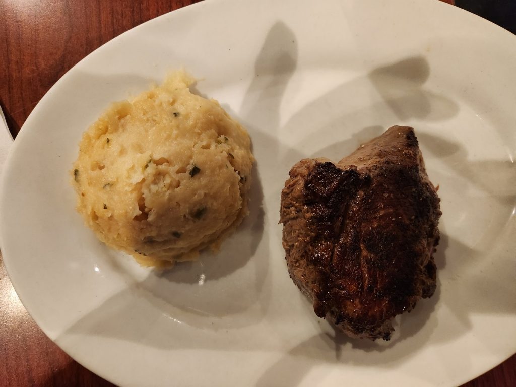
It had been awhile since I had eaten a steak, so I decided on that. I was offered a “side” to go with the steak -and selected mashed potatoes. The steak and potato dinner was around $28 dollars – the same as I would have expected anywhere in America. Prices of daily necessities aren’t noticeably lower in the East or in the South, with the exception of gasoline which seems to average around $3.20 a gallon in most States compared to current California prices of around $5.00 a gallon. Other than that most things are about the same price everywhere.

My steak and mashed potatoes arrived, taking my breath away at my surprise. Admittedly, I ordered steak and mashed potatoes – and got them. But I wasn’t prepared at the stark presentation of just being a scoop of potatoes next to a chunk of meat with nothing else. Not even a sprig of parsley.

The meat was OK, the potatoes what they looked like. I just sat there thinking how bizarre it looked – thre had been zero effort at anything other than the absolute minimum basics – two boring things sitting in the middle of a white plate. I realized that in some way this plate was an example of what I had been experiencing for the past month and a half – everything seemed to have been drained of interest, beauty – humanity. With a few notable exceptions, the rooms at the hotels were all just concrete boxes sized and outfitted with an eye toward “minimally acceptable functionality” and a minimum of cost. I slept in dozens of identical boxes stacked together with no intent of providing anything “extra,” even if the extra in the form of color, art, interest or anything else could be provided at little or no expense. It wasn’t so much a process of saving money, it was a process of making everything uniform, noncontroversial – “dependable.” It had come to feel something like; “Slop, plop, there is your gruel and there is your corner of the room.”

Even places that had been eclectic and vibrant just a few years ago, such as Key West, have been turned into shop after shop selling identical trinkets and clothes, boring bars and “cute” restaurants – the eclectic and vibrant are no where to be seen. Places such as the South Miami beaches are all fenced off and protected, nothing to see or do there – except be amazed at the billions of dollars represented by gigantic homes facing the ocean with their “butts” facing the hoi polloi. “We got ours, now go home.”

It feels like America has lost its soul. It is just hunkered down, either waiting for the end times or drifting like the lounge chair vacationers in the 2008 animation “Wall-E” produced by Pixar Animation Studios. Most of the “action” has bypassed the biggest swaths of America. Entertainment and adventure have been reduced to things that are “dependable” – and boring.

Hubert, North Carolina 6/16/23

Yesterday morning I was all set for a causal, take it easy day. I had a great view of the beach as Myrtle Beach with plenty of time to go to my next destination of “some place” near Jacksonville, NC. I followed my new “normal” routine of picking a destination within 150 miles in the general direction of intended travel. Jacksonville sounded interesting, and could be reached via a smaller highway along the coast. I then used Expedia and others to check on what sort of hotels are available, looking for something in an interesting place and “reasonably” priced – or just reasonably priced, or sometimes in a good place but not so reasonably priced. I don’t have a good approach for the selection criteria – but once selected I call the hotel directly. I attempt to avoid all of the booking agencies because they are almost always wrong about almost everything having to do with the specific properties, such as availability of washing machines, the room selections, availability of restaurants, etc. They are quite willing to give information, but it is not dependable. I try to call the hotel.

On this day I called a hotel and actually got into a conversation with the person on the phone. We chatted for a bit, he offered me a good price because I sounded like a “nice guy,” I accepted and offered to bring a bottle of wine to share with him because he sounded like a nice guy. This was certainly the first time on this trip that I even vaguely contemplated doing anything like that. He said that the trip should take a little over two hours and that I could check in whenever I want because the room was open. That sounded perfect, a late start, and early arrival and time to check out the area.

However…. my GPS decided that it would be another good day for a long sight-seeing trip rather than a direct line to our destination. (I now consider the lady in the dash board my traveling companion even though she gets a little bossy at times.) Instead of taking the two hour trip on the main drag, or the slightly slower ride along the coast, “she” decided that we should go on the six hour drive further into the center of North Carolina, approaching the destination from the west instead of from the south. It is difficult to determine which route has been selected because the GPS just shows the next intersection, not the entire route. Paper maps show the big view, but not the details at the intersection scale. When starting in the middle of a congested city with unknown roads going in a lot of directions it is difficult to know how to best get untangled on onto the correct route. Unfortunately, in larger metropolitan situations by the time you get on the open road you have traveled so far that the route choices are blurred. In any case, we went west before going north and finally back to the east.

I was sort of happy to be going on the “less traveled” path because it gave me a chance to see the “real” county side, and what I saw reminded me a lot of the early parts of my trip – lots of abandoned store fronts, run down or abandoned homes and poverty. Interestingly, this wasn’t nearly as uniformly distributed as in the earlier parts of my travels. This time there were big, fancy, well cared for homes with the columns and long driveways that I think about with the south, surrounded by very large agricultural lands, and then run down houses and broken towns. I couldn’t help but think that this must have reflected the situation in the early 1800’s or earlier. Land owners in big houses, field hands in small shacks, small towns barely hanging on. It wasn’t all like that, clearly there had been a time in the recent past where the economy was better and the average home newer and “modern” with vibrant towns.

I started looking for wine about 50 miles from my destination in the hopes of finding a bottle of chilled wine that would remain chilled until my arrival. That was much easier said than done. I tried grocery stores, but most don’t carry alcohol at all. Those that do have a tiny wine selection of cheap wines, perhaps suitable for cooking. Nothing that I would want to bring as a gift. The liqueur stores have hard liqueur, but no wine or beer. You have to sleuth out a “wine store.” I finally found one, and it was well stocked with nice wines – even chilled chardonnay. It wasn’t cheap, but suitable as a gift.

I finally pulled into the “hotel” at around 4:30 pm – tired but happy to stop driving. The hotel was not at all what I had expected.

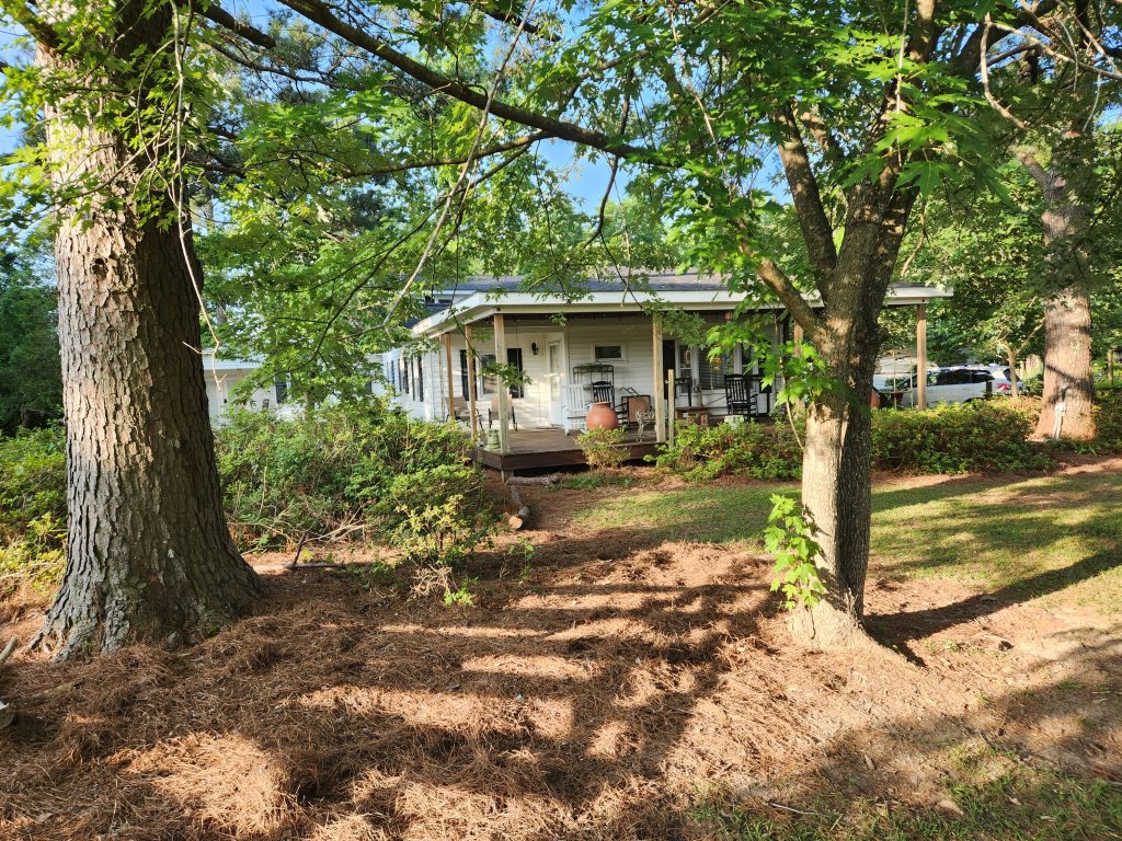
When I got there a guy ran off into the woods, returning a few seconds later to tell me that Robbie would be there in a minute or so. Soon a guy with a 10″ goatee, short cropped hair, and working clothes emerged from the forest on a riding lawnmower. He looked like a “good old boy” if ever there was one – but he was smiling broadly when greeting me. He said that they had been working on keeping the 21 acre property under control, a constant battle in this part of the world. Robbie welcomed me, informed me about a few “house rules” such as where to park, taking shoes off before entering the house, watching out for fire ants and things like that. He then told me about some of the history of the house, where some of the construction wood came from, pointed out 300 year old wood beams, and much more.

I am probably getting much of the detail wrong, but my understanding is that he grew up in southern California, became a realtor in the Miami area selling the mega-mansions that spoke of a few posts back, got fed up with that, purchased the house that is now his “hotel” over twenty years ago to turn it into a retail store, finally got sick of that and went into the hotel business. It must have been some store. Apparently some of the old stock remains, five foot tall giraffes, nice floor and table lamps, unusual wall art and all sorts of interesting things.

It is difficult to sort out which part of this hotel are associated with which hotel rooms because there it is almost all common areas separate by walls and things but no doors. For example, I have a bed room and bath with a door – that is clearly “my” space. But then there is an associated “living room” filled with nice leather sofas, a round table with chairs, end tables and things – it is a living room connected by an open passage to a full up, modern kitchen. The kitchen is a common space, is “my” living room?? And then there are two other apartments similarly situated, and similarly open onto the kitchen. It is difficult to know where one space ends and another begins. I guess that it is the point. There is a young lady staying somewhere in the house, but I have no idea where so I am hesitant to go poking around looking a things – it wouldn’t do to walk in on her.

We finally sat down in “my” living room to share a little wine – and the stories started flowing! I guess he decided that I was a kindred “progressive” liberal and he could talk openly about his political views. Everything he said made perfectly good sense to me, we are definitely on the same wavelength. He said he wore the beard, short hair and clothes as part of his “disguise” in order to be accepted by the locals. He wants to do what he can to moderate the current political unrest and is taking the approach of working from within – not exactly to disrupt, but instead to change opinions by informing them of things they might not be aware of. His opinion is that they would make better decisions if they had better information, but it is difficult to get that here.

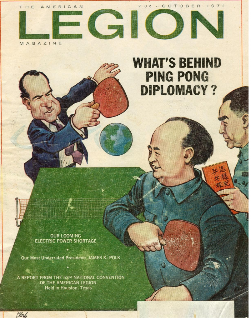
We talked about churches (he told me that there are something like 65,000 DIFFERENT Christian denominations, all of which claim to be the one true path to Jesus), we talked about politics, we talked about Trump and his supporters, we talked about how the locals don’t really care about the politics or truth – they care about being “on the team.” He agreed with my assessment of the collapse of the economy, suggesting that perhaps it all started with “Ping Pong Diplomacy” under President Nixon.

Robbie postulated that opening trade with China resulted in the loss of many of the bread-and-butter industries in America, decimating much of the economic backbone of rural America. Combining that will the repaid “industrialization” of agriculture resulted in what I have been seeing.

Robbie then brought up an interesting project that he has been trying to get off the ground. I don’t recall exactly what he called it, but it is something like HRTP (Hippies Return To Politics). His thought is that the hippies abandoned their political passion in the late 1970’s, and need to return to help right the wrongs by reminding everyone of the need for rational, considered, and fearless truth seeking. He wants to bring small groups of divergent people to work on local problems – but without politics or religion allowed in the discussions. His main rule would be that if any brings up politics or religion, they are not allowed in the group. Just facts, just logic, just finding ways to solve problems – period. I think this is a great idea. In fact, I think it is exactly what my wife was doing so well in our home town. She seemed to be the glue where local people of various political and religious persuasions could come together to solve local problems, whether it be keep the prisons out of our community or building a beautiful new library. We should be able to figure out how to do that – just focus on the actual problem at hand, forget all of the other stuff. Perhaps we can then learn to know, and respect, each other.

This was one of those stopping places that I was hoping to find on my trip. I have had a few interesting people, and have had some interesting conversations, but this is the first that was long enough, and private enough, that we could actually get down to sharing thoughts, insights and experiences.

Myrtle Beach, SC 6/15/23

Once again my travel plans went askew. My plan was to take the short (less than 120 mile) trip from Summerville to Myrtle Beach. I located an older hotel that faced the ocean for a reasonable price, so was all set. I started earlier than usual so I would have plenty of time to dip my feet into the ocean, explore the area and have a bit of a relaxation vacation. However, since the trip promised to be so short, I decided to make it a looping trip going a bit west into the “body” of South Carolina as a sight seeing expedition – nothing big, perhaps adding an hour to the trip.

I noticed a pair of big lakes not far to the west with a road running north between them, and then an easy loop back toward Myrtle Beach and my room. This started out fine for the first 15 or so miles, but then I found myself on a newly constructed section of road – making my GPS show me out in the middle of a field or something. The road wasn’t in it’s memory, so it gave me no suggestions. After a few more miles I came to a big brand new road running north, it was Volvo Road, it was also not on my map. Out of curiosity I took since it was going in the general direction as my planned route. The first thing I came to was a giant, new solar farm. And then many huge new buildings, some obviously intended for manufacturing new Volvos. The new building projects went on for miles, from the names on the signs I gather many are for Volvo’s suppliers. I believe I was traveling in a brand new manufacturing city intended to make Volvo vehicles, perhaps cars, perhaps trucks, perhaps both.

Finally getting through the new construction I came to an older road that turned out to be close to my intended route. I find it difficult to program my car GPS for a route with several waypoints, it keeps insisting on the shortest and/or fastest route. That is not what I am doing, so my solution has been to set a destination along my preferred route, changing it as I go to follow my waypoints. I did that and away we went. However, after traveling for about 30 miles I found myself back at the exact same location that I had been when I set the new destination. I had gone in a big circle. I then tried another route, which worked – sort of, but I found the GPS to be trying to take me on more circular routes along the way. I had to pay much closer attention to my paper maps to prevent just driving in circles all day long. My machine seemed to have had a stoke or something, I hope it was temporary.

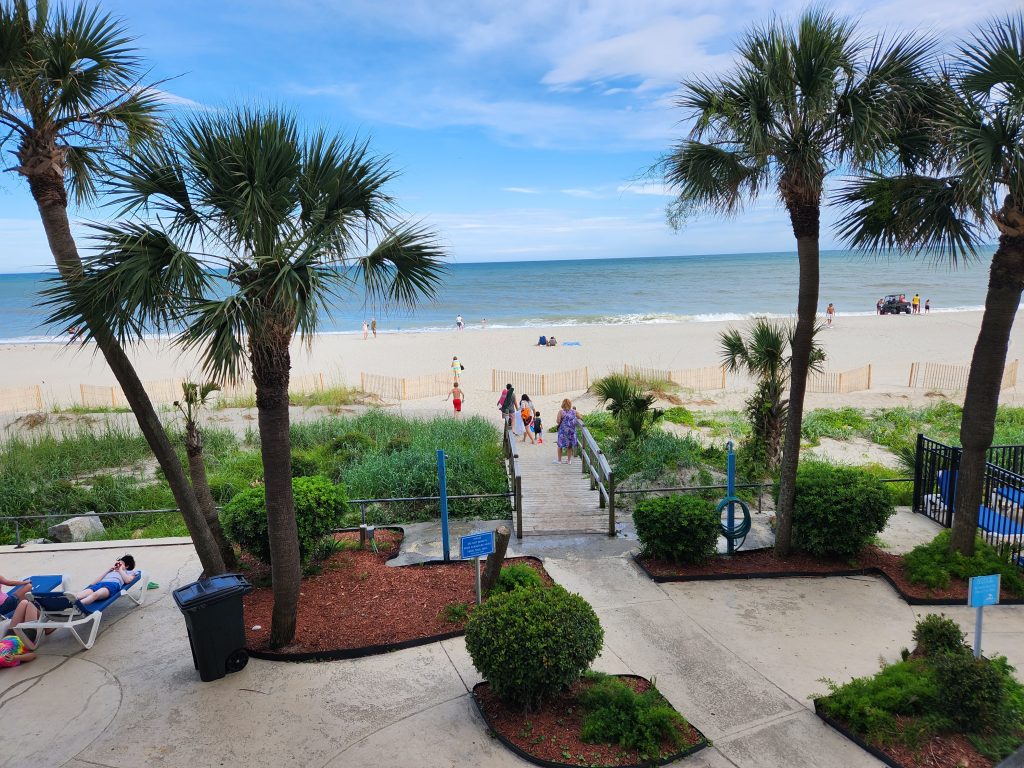
I finally got to 1001 S Ocean Blvd in Myrtle Beach, but there wasn’t actually an address like that on the buildings. There was a 986, and a 1023, but no 1001. Apparently I was to the wrong 1001. I had noticed a north Myrtle beach on the paper map, so I put that into my GPS and it was happy. Of course that was also 30 miles away through city traffic. I finally got to that location, but once again there was no address and no hotel. I broke down and called the hotel. They laughed and said I was at the north end, I needed to be at the south end telling me to enter the zip code into my GPS. My GPS has no place to enter a zip code. So, based upon their new directions, I set a new destination to 1001 S Ocean Blvd – only to end up taking a different route to the non-existent place that I had originally found. Back on the phone with the hotel, this time they admitted that they didn’t know how to tell me where to go, but that some customers had found the place with Google Maps. I don’t have Google Maps on my phone, so after about 15 minutes of messing around with that I managed to get it installed and when I typed in the address it took me off into yet a different direction, perhaps in between the first two attempts. My phone showed the new map in a square of the display that was about 1″ x 1″, totally invisible under the best of conditions and totally useless while driving. However, it seems to get me to a general location that was different from my first attempt. I pulled over and entered the name of the hotel into my car GPS for “around here” businesses and apparently I was finally close enough to be considered “around here.” It then took me to the hotel and a third 1001 S Ocean Blvd, Myrtle Beach. I wonder how many more instances of that address are on that road. At least my room has a great view of the beach and ocean. The photo is taken from a little balcony of my room.

So my “quick” trip ended up with an added hour of circling in the country and two and a half hours driving back and forth from one end of Myrtle Beach to the other. I finally got settled in to my room a little after 5:00 pm – in just enough time to go get a beer or two and dinner before settling in for the night.

While driving back and forth through town I noticed a rather odd thing. I started noticing miniature golf courses – huge, fancy ones. I counted nine of them, and didn’t start counting until it became obvious that they are a “thing” here. They feature large man-made mountains, spectacular water falls, lots of tropical trees and bushes, and theme things like pirates, dinosaurs, space ships, aliens, and much more. In between the miniature golf there are things like go-cart tracks, climbing structures, big artificial trees strung together with ropes that people swing, climb and scramble along. Arcades of various sorts fill in some of the other spots. It is a 30 mile long adventure park with amusements of all sorts – from kids to adults.

Summerville, South Carolina 6/14/23

Yesterday was not what I had intended. As has been my standard morning practice, I got out the map, searched for a town about 150 miles away in my general planned direction of travel. I then search for hotels that seem promising, and reserve a room for that evening. That way by the time I am exhausted after a day of travel there is a bed waiting for me.

Yesterday I followed my normal approach and found the town of Summerville South Carolina (just to the west of Charleston) to fit the criteria at 158 miles, with a suitable hotel. I booked the hotel, plugged the address into the car GPS and headed out. The first clue of things going haywire should have been that the address that I entered didn’t register with the GPS. However, since there have been a number of glitches with the GPS I decided that it just didn’t have that address and I would be able to find it once I was in Summerville. The second clue should have been that it showed the distance as 120 miles rather than 158 miles. This time I decided that the GPS must have plotted a different route than the on-line ap that I had used to find the location. I was willing, and happy, to have a short driving day- looking forward to an opportunity to look around the Charleston area a bit.

At about the 100 mile point in the I noticed a sign for a University of Georgia campus. That was odd, since at 100 miles I should have been well within the state of South Carolina. I then got to looking at the business signs along the road, some of which mentioned Georgia, but not South Carolina. It finally dawned on me, there is a Summerville in Georgia as well as one in South Carolina, and I had forgotten to update the “state” in my destination. I was almost at the wrong Summerville, and the one I wanted was still 160 miles away! Now I had no idea where I was, and wasn’t really sure which town had my hotel. I never did figure out where I was, I couldn’t find Summerville GA on my paper map and the GPS wasn’t much help because it is shows too small of an area. Almost none of the highway signs indicate the name of the road. Instead of spending too much time trying to get oriented I decided to blindly follow the directions of the GPS. It eventually took me to a town that was large enough to be easy to spot on the map, but that really didn’t help much. I just gave up and drove where the arrow pointed.

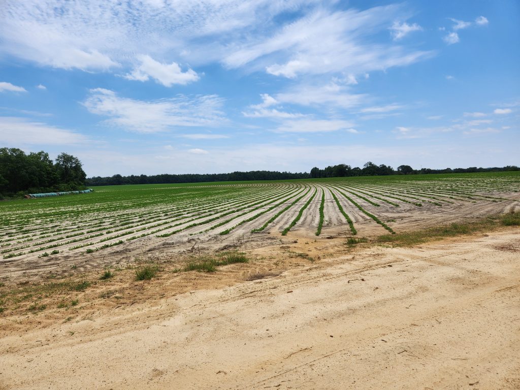
At one point it was time to give my friend our weekly phone call, so I pulled off onto a side road for awhile. I thought the furrows in the field made an interesting view, so I took a photo. The field behind me had small cotton plants. A farmer drove down the road and stopped to say something. I feared that he would scold me for parking on his land, but instead he asked if I needed any help. How nice.

The rest of the trip was long, but uneventful. I took a rather long looping path toward the west, then back around toward the east where I ended up in the correct Summerville! It turned out to be a very nice hotel, much better than 99% of my normal haunts. I told the clerk of my error, which made him laugh. He told me of another customer who did something similar, hoping to be in Summerville Indiana. He didn’t have a reservation so he just checked in when he got there. The next day the guy showed up at the desk asking how to get to the address of the business meeting he had traveled to attend. He had spent the night in the wrong state!! At least I got to the correct place, it just took awhile longer than expected to get there.

I didn’t see or experience much of note on my long day of driving except to note how much of my trip through Georgia and South Carolina was through swamp lands. There were the normal walls of trees next to the highways, but these trees were different, they were standing in water. I don’t know how much of the northern part of Georgia and the southern part of South Carolina is swamp land – but it is a LOT. I haven’t yet picked my next destination – I hope it doesn’t take so long to get there.

Jesup, Georgia 6/13/23

Yesterday was mainly a long drive finally escaping Florida. I had hoped to continue up the eastern seaboard, but my map doesn’t indicate any obvious roads for doing that in Georgia. It looks like the Interstate 95 is about as close as you can get by car, and that is ten to fifteen miles west of the ocean. There are a few roads that go east to the ocean serving the occasional towns, but they go east-west, not north-south. I decided to give up on visiting the Georgia coast and just make a bee line north traveling further inland along the highway 301 route, by-passing Jacksonville. It was an interesting and pretty route through trees and a few small towns along the way. My drive ended up being about 230 miles, much longer than my goal of “close to 150 miles.”

Once I entered Georgia my GPS display began to indicate a large body of water just to the west. I couldn’t see any water, and there were no roadsigns indicating what was there, but it was clear that I was near something large and wet. Eventually I started seeing the word “Okefenokee” showing up in the name of businesses giving me the hint that perhaps I should pay a little more attention. The reason that I missed the fact that I was almost driving in the Okefenokee Swamp was because of a habit I have acquired concerning handling my paper maps.

My car GPS screen shows a very “zoomed in” view that seems to vary from less than a mile to up to perhaps ten miles extent. Nothing beyond five miles away shows on the display, and even then it seldom names things besides nearby roads. That works for overall getting from place-to-place, but doesn’t provide much of a global perspective concerning what interesting things might be nearby. I use a paper map for staying oriented, and to check the GPS because it has a tendency to get things very wrong from time-to-time. It is not a good idea to just trust the GPS and blindly follow its directions. I have already chronicled a few instances of driving many miles to discover that the road dead-ends or took me down paths that just loop and then dissolve.

The paper maps are important, but BIG. While fine for us on a tabletop, they are difficult to deal with in the car, so I carefully fold them into a small 8″x8″ square showing my intended route. That usually works fine for keeping things under control and allowing me to glance at the map as I go through the day. In this case, the fold hid the fact that I was traveling along the swamp, and its presence didn’t show on the GPS display. I almost missed it entirely.

I finally came to be big sign pointing to the Okefenokee Swamp State Park about 25 miles out of my intended route. I have always been very fond of the name, so I decided it was worth adding fifty miles to my driving day to see it.

The State Park is sanitized tourist spot, with nicely paved roads and a parking lot in front of the visitor center, nice paved walking paths, buildings displaying almost nothing, and a guard station ready to receive your $20 fee to see the trees and a bit of water logged ground. The visitor center was filled with mementos for sale, a shelf full of snack food, and the skeleton of a large alligator. This building’s main reason for being is to sell tickets for their “adventures” of riding in a small boat for 30 minutes (a $30 a person), or riding though the trees on a narrow gauge railroad (for an additional $30 fee). I opted to take the free walking path.

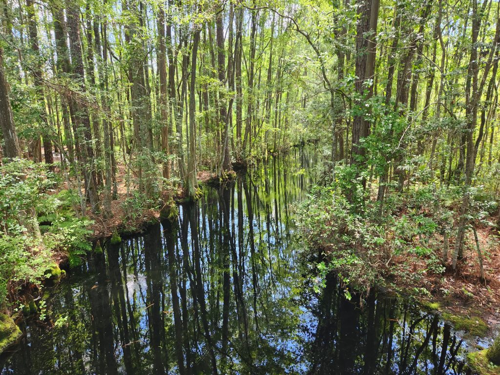
The walking path was nice and quiet. I had a hard time finding a way to get a meaningful photograph, finally settling on just a simple photo of a little creek and some trees. I saw very few critters on my short walk, the water was almost black so it hid anything that might lurk there, and the foliage so dense that it would be very difficult to spot anything. It really reminded me of some scenes out of movie that I saw a few years ago – perhaps it was “Deliverance,” perhaps not. The movie included a jail break from a Georgia prison by a couple of guys who hid in the swamp, staying with a group of people who lived in the swamp hiding from whatever it is that they had to hide from. I wouldn’t be surprised to learn that this park was the settling for the filming, it looked exactly the same to me. I tried to imagine trying to live there without making a clearing and buildings, it would be a difficult and uncomfortable place to camp.

I was glad to have taken the time to visit the swamp, but felt more like I was looking at it through a display glass than actually getting any “feel” for the place. I suppose that was for safety reasons, there ARE giant alligators and nasty snakes in those woods.

Continuing on toward Jesup was uneventful with the small exception that my GPS got lost and couldn’t find the hotel, and the hotel sign was hidden by a tree from my direction of travel. I overshot a couple of miles, turned around and easily saw the sign on the return trip. The main criteria that I had used for selecting the specific hotel was the need for a washer and dryer because I was out of underware, socks, shirts and clean shorts – basically everything. It was laundry time again. It turned out that they hotel doesn’t actually have a washer and dryer – they just said they did. I always call the hotels direct because this sort of thing happens almost every time I got through a hotel booking agent. They have no clue about anything specific, and in fact often don’t even know where the hotel is located. It is common to get reservations for a different hotel in a different state and if you aren’t paying attention you don’t get a reservation and since I book on the same day there is no refund. The services such as Expedia and the like know nothing of anything specific about the place such as availability of food other than fast food, availability of amenities, room or floor selection or anything important.

So I was unable to do my laundry at the hotel, and I arrived after 5:00 due to my side-trip to the swamp. Luckily the hotel had a flyer from a nearby service that could take care of my washing for me – for a small fee of course. The flyer said they were open from 7:00 am to 8:00 pm, so I had time. However, they meant 6:00 pm not 8:00 pm, so I would have to wait until around noon on the following day, and there wasn’t time to do the clothes in the laundromat. Luckily the nice lady offered to work a few minutes past quitting time to take care of my clothes. I dropped them off, went to a local bistro for a beer while waiting, and it all worked out fine.

That pretty much describes the excitement for the day. Many days are filled with similar hours of just driving, and taking care of dinner and necessities.

Flagler Florida 6/11/23

Florida is taking a lot longer than I had anticipated. Not only is it very long, but there are things that seem to demand a little longer look than just spending the night. Key West was one of those places. Not that there was really much there besides rather silly “tourist” things, but just because it has occupied a place in my “bucket list” for many years. I think it would be an entirely different, and more fun, if I had taken the time and effort to get involved in water related things such as fishing, snorkeling or just swimming. But I didn’t, I stayed with my feet firmly planted on the ground. It was pleasant, but I am unlikely to return any time soon.

It took a few driving days to finally get back to beach front roads. The lower half of the state has lots of beaches, but they are all either behind private fences, or require more effort than I was ready to spend for the public beaches. I peaked in a few times but only saw people sitting or milling around on the beach, doing nothing much. I like to do that sometimes, but this was not the time.

After looping inland and driving a hundred and fifty miles on totally boring highways through trees I came upon the little town of Flagler. It immediately appealed to me. For one thing it sits immediately on the beach, which is totally open, accessible and parking is free. It feels a little like a “surfer” town from the ’60s. I ended up in a rather funky, run down and poorly maintain hotel called Topaz Motel.

I was immediately drawn to it because it was NOT anything like the Best Western hotels (and others) that I have been staying at on most nights. It is true that there are only two working outlets, and those are used up by the hotel things such as lights, clock, refrigerator, etc. I have to unplug some essential item in order to plug in a computer, charge my phone or other things. The room comes with an in-room jacuzzi but it is all rusted, in pieces and has a big sign to NOT use it because it is broken. It just takes up room in the corner. The television doesn’t work. My biggest disappointment is that while I managed to get a room overlooking the ocean, the shades can’t be moved aside so there is no view of anything. The Motel itself is well on its way to becoming a hole in the ground. Rot and broken things are the most obvious features – but I like it in spite of all that. It feels right. I like it so much I decided to stay a second night.

The beach is quite close, perhaps 200 feet from my room, across road A1A which is pretty quite here. If I walk across the road to be able to see over the top of the protective dunes, I see something like this view:

Last night I walked less than a half a mile toward town and found a really nice open air bar that had live music playing many of my old favorites from the “hippy” days – the musicians were vintage also. I got so engaged it listening to the music that I forgot to order dinner. By the time I remembered that I was hungry every restaurant in town was closed. The band stopped playing at 9:00 – it wasn’t as if I had stayed up until the cows come home. A bit of moldy cheese and a handful of crackers made do for dinner.

By morning I was pretty hungry. A short walk back toward town brought me to a “resort and spa” that advertised breakfast and that it was open to walk-in customers. I walked in. The menu had none of the offerings in “normal” American diners. No grits, no hash-browns, no eggs any way you want them. I ended up getting an egg crepe. It was beautiful, I should have taken a photo of it, but didn’t think of that until I had finished eating it. It started as a round crepe covered with some sort of meat based filler, then the edges were folded over to make a square shape with a hole in the middle where the sunny-side egg sat. It came with fresh fruit and great coffee. The chef came out of the kitchen a couple of times to check on how I was liking it. What a nice breakfast. It was pretty, tasted great, with a beautiful of the early morning ocean with a few fishing boats out at sea and little gangs of pelicans gliding along the surface of the water. On top of that, but the waitress was cute and friendly. It was a perfect breakfast – the best meal of the trip.

It was a little funny watching the surfers attacking the waves during the morning. Most of the waves were perhaps five inches tall and barely made the waiting surfers bob in the water. About every ten of these ripples turned into a rideable (noticeable) wave. The largest that I saw was perhaps a foot high, but it was enough to push the surfer toward shore. The whole thing was a slow motion encounter with the sea, where there was a lot of hoping and fantasy, but not a lot of action. By afternoon I see that things have changed a bit. There are some white caps offshores, and a few low breakers. It might actually be surfable.

I think I have modified my travel plans in some significant ways. My son, Kevin, called yesterday and offered me a little advise about how to get home quicker, easier and cheaper than just forcing a long drive home. It is about 3,000 miles across the country. At my normal rate of 150 miles a day, that is 20 days of driving until exhaustion each day. I realize that 150 miles is not much for normal folks, but it is just about the end of my tolerance on a regular day-in day-out basis. I had planned on 20 days to return.

Kevin asked if perhaps I wouldn’t be better off shipping the car home and flying. That seemed reasonable, I think it costs something like $2500 to ship a car across country. It is costing me almost $200 a day in my current mode of travel, which would be $4,000 driving. I could save $1,500 and not have to beat myself up. I then wondered about just selling the car on this side and carrying the money. It costs nothing to ship the money. I suppose I can get an airline ticket for around $700 dollars, and can ship the stuff I want to keep in a box for another $100 – saving more than $3,000 and my back.

So that is my current plan. I am going to keep driving up to see my friend Warren and his wife Jill in Maryland, taking about seven days to do that. Spend a few days until they get tired of me, pack up the camping gear, sell the car and fly home. I am getting ready to be home again, so this sounds very appealing to me. Once I get home I’ll go buy a new car, which was my plan all along. I am just sort of “squeezing” the last bit of good out of the car that I am driving.

Perhaps this will get me home around the first of July – a far more relaxed approach to what I was doing. I am really beginning to miss my home, my friends and the comfort of being in my own “territory.”

Miami Springs, Florida 6/10/23

Yesterday turned out to be one of “those” days. It started out in a normal fashion, but quickly unraveled. Since it turned out that Miami Springs was several miles from the coast I decided to drive east until I found water, then turn north for a easy 2 1/2 drive to my next destination. Getting to the coast was fairly easy, I just took a big, many lane road through a forest of giant, super fancy “sky scrapers” that appeared to be mostly banks or 50-70 story apartment houses. I guess all those big banks require all of those people stacked up in the apartments. In any case, all I had to do was stay in the middle lane and keep on going until I could go no further.

I found water, bridges and what appeared to be an island between me and the open ocean. I then plugged the new address goal into the car’s GPS and headed out. The first part of the new trip was through the more “seedy” part of town with the freight trains, garbage facilities, car crushing facilities, bars, strip joints and “adult” toy stores were congregated. I enjoyed it because it was colorful, and the traffic was light. However, I eventually got through that part of town and entered the more upscale parts – and traffic virtually stopped. I had purposefully started traveling around 9:00 am, thinking that I would leave the beach area around 10:00, thus missing the rush hour. If I missed it, I can’t image what that would have been like.

The roads in Florida seem to be uniformly a nightmare – for many reasons, and this was no exception. The roads through town tend to be seven or eight lanes wide, running at 90 degrees to each other. Every couple of blocks the cross using very long cycle time stop lights. So there is a constant crush of cars in all directions at the stop lights. It normally takes 2 or 3 light cycles to progress one block. I is not unusually to finally get to the head of the line and still have to wait though even more cycles because block ahead hasn’t cleared yet. It took me almost 2 hours to go the four miles to get “out of town.”

By the time I roamed around Miami trying to go north I was totally lost. Actually, since I had never been there I started totally lost. I did what I normally do in these situations, trusted the lady in my dash telling me when to turn, and when she is going to recalculate because I failed to follow her directions. However, since my car’s map showed that I was headed north, and the time of arrival seemed about correct, I just relaxed and went with the flow. However, once traffic eased up a bit I started glancing at my paper map to get an idea where I was. The paper map is important because the range shown on the car map is much too close in and detailed – you can’t tell where you are in general. Not only that, but once you set the destination it stops showing it, it just tells you where the next turn is going to be, and it shows the estimated arrival time and distance. I keep looking for road I was on and couldn’t find it.

I finally pulled off the road to concentrate a bit on this problem and finally found it. I was traveling west, not north. It turned out that two things had changed on the map, both of which were unknown to me. One thing was that the map display now was showing the orientation of the map to be “north” rather than what is had been doing for the past month, which was showing the direction that the car is pointed. I assumed the “N” on the display meant I was going north and since the road I hoped to travel was almost due north that seemed correct. But the “N” meant that the map was oriented north, but I was actually traveling west. A slight confusion. Then I noticed a much larger problem. The road that I had entered for next hotel was Okeechobee Road, but somehow or another that became the city and the map was set to take me back to the hotel that I stayed in a week ago in the town of Okeeechobee, and I was almost there!! Suffice it to say, my nice 2 to 3 hour drive turned into a grueling 8 hour drive without even a lunch break.

At least there was a nice Mexican restaurant within walking distance from my new motel. The hotel is one of the typical clusters of hotels and fast food joints at the intersection of large highways, with lots of big rig trucks everywhere you look.

Hopefully today with be a bit better. I am going to have to drive longer days if I am going to get back by mid-July.

Miami Springs, Florida 6/9/23

I turned a corner and am now heading north. I mistakenly thought that I could make the 125 mile trip from Key West to Miami Springs in about three hours, leaving me plenty of time to go the 30 miles to the beach. I failed to add in the last nine miles from Miami South to Miami Springs. That nine miles took a little over two hours, and there was no accident or road work, and it wasn’t even “rush hour” yet. The roads have stop lights every other block, and it took two or three cycles for each stop light. That used up the “extra” time I had planned for a trip to the beach.

I got another room in a Best Western, the best so far. Nice, quiet, everything in good order, great free breakfast – and an Irish Pub within easy walking distance down the street. It was sort of easy, because it was also pouring rain – in bucketfuls. I drove.

The pub was separated into two parts – an outside bar that was packed with guys (no women) with not even standing room available, and an inside bar/restaurant that was much quieter, and I could get a seat. I chose the inside options and got into fun discussions with a couple of older gentlemen. They told me their names, but I forgot them.

When they heard that I was writing about my travels they wanted to know if they would be included, and I said that it is likely. So they wanted a photo to go along with it. The bar tender took the photo for me. This morning I thought it might be fun to use that at practice sketching since I have always been afraid to attempt drawing people. Here is my effort, the second attempt in my life. A week or so ago I attempted to draw a sketch of a friend of mine, and it came out rather ghoulish. This one isn’t much better, but it gives a feeling of the moment. While it doesn’t classify as “good” or even “art” – it was fun to do and gives me a little hope that with practice things might improve. At least they look like three different guys.

I also stopped in at a little bar and grill for lunch on one of the Keys. I don’t recall which key, or the name of the place – but they served a pretty good burger, and three others in the place carried on a lively conversation. They indicated that I had walked into a local establishment, not a tourist place. It was interesting to hear what they had to say about growing up on the keys, and how difficult they found living in the city to be. They just grew up “country” and that seems difficult to get past. They had all “gone out there” – only to return to a place where they could relax and breath a little.

I am going to continue north this morning, but perhaps making a bit of a loop toward Fort Lauderdale just to see what I can see. My good friend Warren used to go there on spring break, I was always curious what was drawing him across the country to do that. I am still curious, so will take a fly-by knowing that I won’t see much.

Key West, Day Two

I decided to break my travel plans of moving every day in order to give myself a break, and perhaps have a little more time to experience Key West. It is clearly a different sort of place that requires a little more time to get the feel of it. Actually, it would take a LOT more time for that. I will just be scratching the surface.

I realized that I would be missing a lot if I didn’t take in at least one beach side restaurant. Therefore I went to Dog Beach which has free beach side parking. I parked at a memorial beach honoring AIDS victims, which was right next to a slave cemetery. The sign on the slave cemetery told about a pre-civil war situation where a couple of American ships were illegally bringing in loads of slaves. The American navy caught the ships and rescued the people on board, but conditions had been so bad on the illegal ships that something like 300+ men, women and children ended up dying from illnesses they contacted on the journey. Those people were buried on this beach. The remainder were cared for in the hospital on the island and eventually returned to Africa – but not necessarily to where they had been. Yet another sad chapter in the story of American enterprise.

Next to these two beaches is a “garden club” garden located in an old brick fort. Beautiful garden, well laid out and signed. Finally I came to a beach side restaurant, and took a table facing the Atlantic Ocean.

After lunch I headed back to my hotel, stopping at an old fort that had been made into a museum. The museum had some interesting displays concerning Cuban refugees from the past sixty years or so. Other than that it was the normal collection of old pianos, old tools, old cannons – old stuff. The evening I hung out near the hotel pool and met a couple of very interesting people. In a place such as Key West perhaps the interesting people are the “tourists” – they come with interesting tales of their lives. One of the guys I met is an ex-marine. Finally having gotten his fill of the adventures that come with carrying guns into war zones, settled down, had children and is now one of huge “army” of utility workers re-wiring America. He was in Key West working on that project. Another guy that I met was a commercial airline pilot but got into a horrible automobile accident that put him on the injured-retired role. He now just travels to interesting places, having been in this hotel for about two months on this trip. There were other, much briefer, discussions.

I am going to spend another night in Key West, meaning another day. I am not sure what I will do with my time, perhaps go to some other keys and poke around a bit to see what I might see. The weather has been good; not too hot, mild breezes, almost bearable humidity, and no rain.