Yesterday was not what I had intended. As has been my standard morning practice, I got out the map, searched for a town about 150 miles away in my general planned direction of travel. I then search for hotels that seem promising, and reserve a room for that evening. That way by the time I am exhausted after a day of travel there is a bed waiting for me.
Yesterday I followed my normal approach and found the town of Summerville South Carolina (just to the west of Charleston) to fit the criteria at 158 miles, with a suitable hotel. I booked the hotel, plugged the address into the car GPS and headed out. The first clue of things going haywire should have been that the address that I entered didn’t register with the GPS. However, since there have been a number of glitches with the GPS I decided that it just didn’t have that address and I would be able to find it once I was in Summerville. The second clue should have been that it showed the distance as 120 miles rather than 158 miles. This time I decided that the GPS must have plotted a different route than the on-line ap that I had used to find the location. I was willing, and happy, to have a short driving day- looking forward to an opportunity to look around the Charleston area a bit.
At about the 100 mile point in the I noticed a sign for a University of Georgia campus. That was odd, since at 100 miles I should have been well within the state of South Carolina. I then got to looking at the business signs along the road, some of which mentioned Georgia, but not South Carolina. It finally dawned on me, there is a Summerville in Georgia as well as one in South Carolina, and I had forgotten to update the “state” in my destination. I was almost at the wrong Summerville, and the one I wanted was still 160 miles away! Now I had no idea where I was, and wasn’t really sure which town had my hotel. I never did figure out where I was, I couldn’t find Summerville GA on my paper map and the GPS wasn’t much help because it is shows too small of an area. Almost none of the highway signs indicate the name of the road. Instead of spending too much time trying to get oriented I decided to blindly follow the directions of the GPS. It eventually took me to a town that was large enough to be easy to spot on the map, but that really didn’t help much. I just gave up and drove where the arrow pointed.
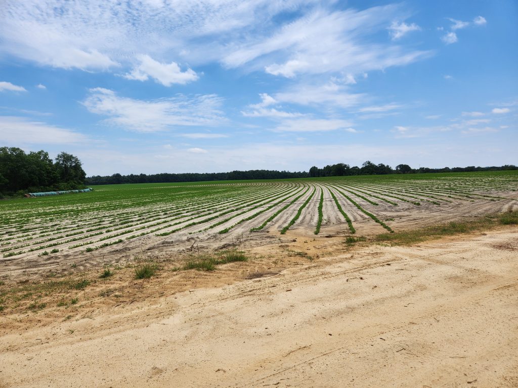
At one point it was time to give my friend our weekly phone call, so I pulled off onto a side road for awhile. I thought the furrows in the field made an interesting view, so I took a photo. The field behind me had small cotton plants. A farmer drove down the road and stopped to say something. I feared that he would scold me for parking on his land, but instead he asked if I needed any help. How nice.

The rest of the trip was long, but uneventful. I took a rather long looping path toward the west, then back around toward the east where I ended up in the correct Summerville! It turned out to be a very nice hotel, much better than 99% of my normal haunts. I told the clerk of my error, which made him laugh. He told me of another customer who did something similar, hoping to be in Summerville Indiana. He didn’t have a reservation so he just checked in when he got there. The next day the guy showed up at the desk asking how to get to the address of the business meeting he had traveled to attend. He had spent the night in the wrong state!! At least I got to the correct place, it just took awhile longer than expected to get there.
I didn’t see or experience much of note on my long day of driving except to note how much of my trip through Georgia and South Carolina was through swamp lands. There were the normal walls of trees next to the highways, but these trees were different, they were standing in water. I don’t know how much of the northern part of Georgia and the southern part of South Carolina is swamp land – but it is a LOT. I haven’t yet picked my next destination – I hope it doesn’t take so long to get there.